
93 residents evacuated as relentless rain batters the Garden Route
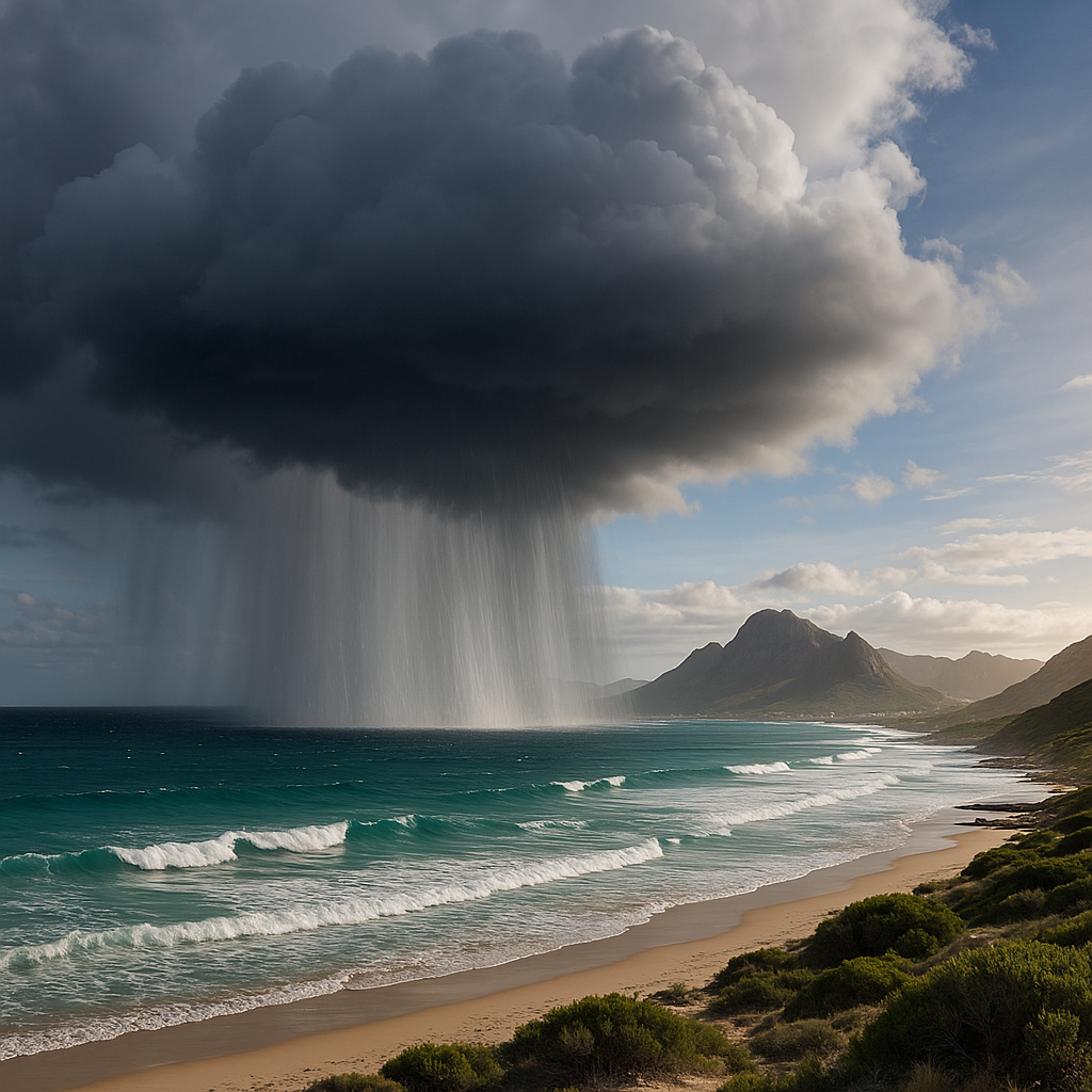
South Africa's Western Cape faces catastrophic floods from a stalled weather system. Red alerts issued as heavy rains cause evacuations & widespread damage.
A huge, stubborn storm is causing crazy floods in South Africa's Garden Route. It's raining non-stop, making rivers overflow and roads disappear. People are being rescued from their homes and moved to safe places. The storm is so strong it's even breaking bridges and cutting off power, making life very difficult for everyone.
What is causing the severe flooding in South Africa's Garden Route?
A severe cut-off low pressure system is locked over the Western Cape, continuously drawing warm, moisture-laden air from the Agulhas Current into the Garden Route. This relentless weather pattern is causing record-breaking rainfall, leading to life-threatening flash floods as rivers overflow and infrastructure buckles under the strain.
Get Cape Town news in your inbox
Stay updated with the latest stories from the Mother City.
The Weather Engine Refusing to Leave
A cut-off low has locked itself over the Western Cape, steering a conveyor belt of warm, moisture-laden air from the Agulhas Current straight into the mountain folds and seaside towns of the Garden Route. Bereft of a frontal shove to move it on, the gyre keeps spinning, wringing out sheets of rain that have already shattered multi-day records. Forecasters upgraded the watch from orange to red - their starkest signal that both the volume already measured and the volume still to come could unleash life-threatening flash floods.
Between George and Plettenberg Bay, tipping-bucket gauges have tallied 250–350 mm in three days; the Tsitsikamma escarpment crest has nudged 410 mm. Those numbers translate to 60–70 % of a normal yearly quota. Because the ground is already sodden, every new burst funnels straight into gorges, rivers and ultimately living rooms.
Computer models see no escape until a mid-level ridge shoulders in late on Friday. Until then, embedded thunderclouds will continue to dump 20–40 mm per hour - enough, engineers warn, to tip already swollen rivers into a second, higher crest.
Rivers Reclaim Their Floodplains
At 03:40 this morning the Groot River Dam overtopped its revamped spillway for the first time since its 2021 overhaul, releasing an estimated 180 m³/s. Further downstream, the Keurbooms gauge at Plett touched 8.5 m at 09:15, revisiting the 2006 watermark. Knysna’s lagoon suffered a salt-water reversal, salinity plunging to a brackish 4 ppt and stressing eelgrass beds that shelter juvenile fish.
Great Brak’s main bridge has barely 80 cm of freeboard left, forcing single-lane traffic. The Kandelaars and Olifants are projected to crest tonight, funneling runoff from the Outeniqua massif. To the north-west, Clanwilliam Dam will begin stepped releases that could jolt flow rates past Citrusdal by Saturday.
Hydrologists note that the Kammanassie and Swartberg ranges now act as giant funnels. Their steep sandstone walls accelerate water toward the lowlands, so even a modest cloudburst can amplify an already dangerous hydrograph.
On the Ground: Evacuations and Emergency Shelters
As dawn broke, teams from the 46 Engineer Regiment, Working on Fire and Gift of the Givers spread through the flood-prone pockets of De Rust, Welgeluk, Kranshoek and Rheenendal. By noon the shelter roll stood at 287 people: 93 from De Rust/Welgeluk, 74 from Kranshoek’s riverbank shacks, 55 fruit-farm labourers from Rheenendal’s orchards, and 65 holiday-makers stranded after the N2 closed at Kaaiman’s Pass.
Toekomsrus Community Hall filled first; when cots ran out, the Presbyterian Church hall in Plett opened its doors. Every site now features medical triage corners run by provincial nursing sisters, UNICEF play rugs for restless children, and pop-up kennels courtesy of the Plett Animal Welfare Service. Mobile Wi-Fi trailers keep evacuees connected to insurers, banks and anxious relatives.
Gift of the Givers has pre-staged 60 t of bottled water, 5 000 hot-meal kits and 500 inflatable mattresses in a George warehouse. A mobile desalination rig capable of 60 000 L per day is parked in Plett as insurance against upstream contamination.
Infrastructure Under Siege
Eskom’s Eden cluster reports 13 medium-voltage feeders dark, the victims of lightning-struck poles, wind-snapped trees and two substations deliberately shut before floodwaters reached switchgear. Harkerville, Covie, Sedgefield, Karatara and parts of Wilderness Heights spent the night without power. Engineers are flying drone-mounted LiDAR sorties to inspect sagging pylons before they re-energise lines.
Knysna’s stormwater surged through two Waterfront Drive manholes, shorting underground cables and blacking out traffic lights along Main Road. Jetting crews and temporary over-pumping stations now guard against sewage backflow into the estuary.
Roads are failing faster than teams can inspect them. Beyond the N2 closure at Kaaiman’s Pass, the R339 lost an embankment near Uniondale; the R102 coastal detour is pocked with sinkholes; the R62 at Tradouw Pass is blocked by a boulder blast; and the Langkloof’s gravel arteries have dissolved into braided streams.
A 4×4 driver in Harkerville discovered just how quickly water rises: what looked like a shallow sheet turned into a chest-high torrent in sixty seconds. Rescue volunteers plucked the family 300 m downstream with throw-bags and a static line.
Farms, Forests and Finances
Langkloof’s orchards - already pock-marked by earlier hail - now lie under water. Stone-fruit roots can survive 48 hours of saturation; 1 400 ha of plums and apricots have passed that threshold. The Deciduous Fruit Board has opened an emergency portal for growers to order subsidised fungicide sprays.
Dairies ring-fence milk in cold-storage rooms while 12 refrigerated trailers idle at Mossel Bay harbour, forming an impromptu consolidation hub because tankers can no longer reach low-lying parlours.
South Africa’s insurers have stamped “catastrophe event” across the district. Policyholders can file provisional claims for household contents with geotagged photos; Santam, Old Mutual and Hollard have pooled a R500 million reinsurance buffer so municipalities can start road and bridge repairs before adjusters arrive.
Nature Fights Back
At Swartvlei, freshwater has pushed seven kilometres upstream, flipping salinity gradients and leaving estuarine fish such as dusky kob disoriented. Tannin-stained runoff from fynbos slopes is spiking oxygen demand in rivers and could trigger fish-kill events once the water settles. Sightings of Cape clawless otters on golf-course fringes suggest terrestrial prey is on the move.
SANParks closed the Storms River suspension bridge after a baboon troop commandeered its cables. In Knysna, seven juvenile elephants were herded to raised boma pens, while a sling-load helicopter airlifted five blesbok to higher ground in Plett Game Reserve.
Tech, Volunteers and the Human Factor
The Western Cape Disaster Centre is stress-testing its new Impact-Based Forecasting platform, a blend of Sentinel-1 radar, citizen rainfall reports and river sensors that redraws inundation maps every fifteen minutes. A WhatsApp bot dubbed “FloodBot” pushes those maps to 43 000 residents; it peaked at 1 800 queries a minute during the evacuations. Ride-hailing drivers will soon receive alerts to avoid flooded routes.
Thirty-five private jet-ski owners - self-organised via the “Plett Ski-Buddies” chat - have spent two days ferrying fodder to marooned cattle and lifting pets from farmsteads. DroneOps SA is shooting 3 cm-per-pixel orthomosaics for George Municipality so engineers can spot cracks invisible from the ground.
Telkom’s mobile VSAT trailer at Toekomsrus Hall guarantees satellite bandwidth if fibre fails. Vodacom’s towers in Knysna and Sedgefield now carry 72-hour generator packs. EnviroServ skip bins dot Mossel Bay intersections to corral chemical waste before it pollutes the delta.
Beyond the Epicentre
Citrus growers from the Northern Cape can no longer reach the Port of Cape Town; the 500 km detour via the N9/N12 means reefer containers bound for Rotterdam will instead sail from Durban at a R3.5 million surcharge. Panic buying emptied petrol forecourts in George and Mossel Bay, so authorities tapped the PetroSA terminal’s 48-hour fuel reserve.
The 1830s Drostdy Arch in George cracked as adjacent canals overtopped; Heritage Western Cape has dispatched a conservation architect. Millwood Gold Mining Museum is wrapping artefacts in Tyvek and relocating them to higher shelves as Jubilee Creek swells over historic sluice boxes.
Schools from George to Plett suspended in-person classes until at least Monday. Grade 12 prelims will continue in Uniondale and Avontuur halls under armed escort and strict invigilation. SADAG counsellors roam evacuation centres, handing out free data vouchers so parents can send “I’m safe” messages and kids can keep up with WhatsApp micro-lessons broadcast on Eden FM 93.1 MHz.
Remote assistance is arriving: the U.S. OFDA published 30 m-resolution satellite snapshots of the flood plain; Germany’s THW offered six 6 000 L-per-minute pumps, customs willing.
[{"question": "What is causing the severe flooding in South Africa's Garden Route?", "answer": "The severe flooding in South Africa's Garden Route is caused by a persistent cut-off low pressure system. This weather pattern is locked over the Western Cape and continuously draws warm, moisture-laden air from the Agulhas Current into the region. This leads to relentless, record-breaking rainfall, causing rivers to overflow and widespread flash floods."}, {"question": "How much rainfall has the Garden Route received and what does it mean?", "answer": "Between George and Plettenberg Bay, gauges have recorded 250-350 mm of rain in three days, with the Tsitsikamma escarpment crest nudging 410 mm. These amounts represent 60-70% of a normal yearly rainfall quota. Because the ground is already saturated, this new rainfall is directly contributing to severe flooding, with computer models indicating continued heavy rainfall of 20-40 mm per hour until late Friday."}, {"question": "What are the immediate impacts on infrastructure and daily life?", "answer": "The storm has caused significant infrastructure damage, including bridges breaking, roads disappearing (like the N2 closure at Kaaiman's Pass), and widespread power outages due to lightning strikes, wind-snapped trees, and flooded substations. Rivers are overflowing, with the Groot River Dam overtopping and the Keurbooms gauge reaching 8.5 m, revisiting 2006 flood levels. Evacuations are ongoing, with hundreds of people moved to emergency shelters in areas like De Rust, Welgeluk, Kranshoek, and Rheenendal."}, {"question": "How are emergency services and aid organizations responding to the crisis?", "answer": "Teams from the 46 Engineer Regiment, Working on Fire, and Gift of the Givers are conducting evacuations and setting up emergency shelters. Gift of the Givers has pre-staged 60 tons of bottled water, 5,000 hot-meal kits, and 500 inflatable mattresses. Medical triage corners, UNICEF play areas, and pop-up kennels are available at shelters, along with mobile Wi-Fi trailers for connectivity. A mobile desalination rig is also on standby."}, {"question": "What is the impact on local agriculture and the economy?", "answer": "The agricultural sector is severely affected, with Langkloof's orchards submerged, potentially damaging stone-fruit crops. Dairies are struggling to transport milk, necessitating impromptu consolidation hubs. South African insurers have declared the event a 'catastrophe,' with a R500 million reinsurance buffer established by Santam, Old Mutual, and Hollard to aid in initial road and bridge repairs. The crisis is causing significant financial strain and disruption to supply chains, including detours for citrus exports."}, {"question": "Are there any technological or community-led efforts assisting with the disaster?", "answer": "Yes, the Western Cape Disaster Centre is using a new Impact-Based Forecasting platform, combining Sentinel-1 radar, citizen reports, and river sensors to update inundation maps frequently. A WhatsApp bot, 'FloodBot,' is distributing these maps and responding to queries. Private jet-ski owners are ferrying supplies and rescuing pets, while DroneOps SA is providing high-resolution aerial imagery for damage assessment. Telkom and Vodacom are ensuring communication infrastructure remains operational with satellite bandwidth and generator backups."}]

Emma Botha is a Cape Town-based journalist who chronicles the city’s shifting social-justice landscape for the Mail & Guardian, tracing stories from Parliament floor to Khayelitsha kitchen tables. Born and raised on the slopes of Devil’s Peak, she still hikes Lion’s Head before deadline days to remind herself why the mountain and the Mother City will always be her compass.
View all articles →