
Cairo–Cape Town highway inches closer for cross-continent travel
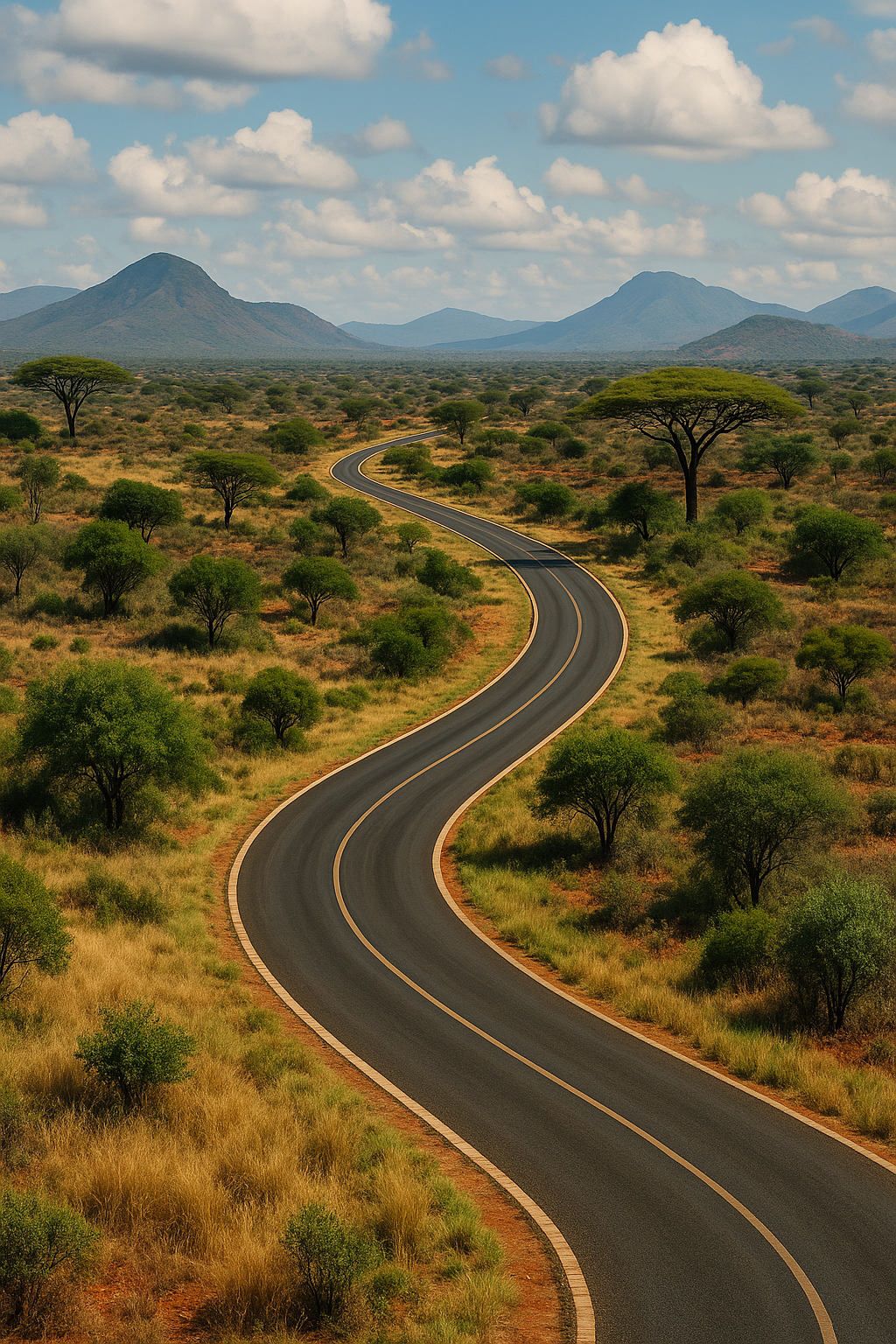
Explore the legendary Cairo to Cape Town Highway: a 10,228km journey through diverse landscapes, geopolitical challenges, and dreams.
Imagine a 10,000 km road from Cairo to Cape Town, a dream that's constantly changing. This route, a "living sketch," wriggles and shifts due to wars, nature, and money. What you drive today is a mix of smooth highways and muddy tracks, with bribes and detours along the way. Despite the challenges, the dream lives on, with technology slowly making borders "invisible" and a grand arch planned for 2034 in Cape Town, promising a future of seamless African trade.
What is the "Cairo to Cape" route?
The "Cairo to Cape" route is an ambitious, ever-changing 10,000 km transportation corridor aiming to link Cairo, Egypt, to Cape Town, South Africa. Initially a theoretical line, it has evolved into a dynamic network of roads, detours, and temporary solutions, constantly reshaped by geopolitical events, natural obstacles, and economic imperatives, yet remaining a persistent dream for seamless African commerce.
Get Cape Town news in your inbox
Stay updated with the latest stories from the Mother City.
1. The Living Sketch: A Line That Refuses to Sit Still
Picture every classroom wall-map you ever doodled on: a single red felt-tip slash from the pyramids to the Cape. That juvenile scratch has grown up but still behaves like a rebellious teen. In 1971 UN economists drew it along the Nile, down the Rift, across the Zambezi and home to the Orange River. Fifty-three years on, the pencil has been replaced by satellite tracks, militia WhatsApp pins and crowd-sourced flood alerts, yet the corridor keeps wriggling east, west, sometimes backwards, always alive.
Civil wars, volcanoes and currency nose-dives treat the route like a bead of mercury. Sudan’s chaos shoved the trace 300 km east toward the Red Sea; Zambia’s toll-gate squabbles nudged it west into Angola’s dusty highlands; Ebola checkpoints and equatorial cloudbursts have calcified into a mirage: a hundred improvised detours now advertised as “the new normal” by freight companies that re-issue the shapefile every quarter. The result is a geographical ECG: every heartbeat redraws the continent’s longest line.
The dream refuses to die because the very mountains, rivers and seasonal storms that sabotage it also make it irresistible. Whoever tames the corridor controls four time-zones, the headwaters of the planet’s longest and deepest rivers, and the only strip of tar where you can breakfast on ful and supper on Cape lobster while sharing tarmac with ostriches, penguins and 40-ton beer tankers.
2. What You Actually Drive Today: Glory, Gumbo and Gated Bridges
Leave Giza at dawn and the first 700 km feel like Germany misplaced in the Sahara: dual-carriageway, solar LEDs that swap colour when dunes hiss across the lanes, and a 280 km desert viaduct on pylons that let the sand slide underneath like snow off a chalet roof. Then Lake Nasser interrupts the fantasy: a rust-eating pontoon ferry that takes half a day to negotiate because every plank predates the internet.
Sudan’s segment, optimistically named the Trans-Sahara Express, is currently a chessboard of teenage gunmen who QR-code your permit and laminate it beside rival militia logos. South of Khartoum the asphalt simply resigns at Jebel Aulia; for the next 400 km you pilot through axle-deep chocolate mousse that forms after five minutes of rain and dries into concrete ruts that rattle teeth for weeks.
Ethiopia greets you with fresh concrete smelling of diesel, courtesy of China Railway’s 14th Bureau, while northern Kenya shrugs and offers murram the colour of cayenne pepper and a police escort who charges eighty US dollars to lead you past Turkana bandit country. Tanzania shows off tea terraces and baboon traffic-jams, but the 42 km cliff-cut at Kitonga Gorge still forces 30-ton rigs to reverse uphill so their diffs don’t kiss the tarmac. Zambia’s pavement is perfect - except where it isn’t: detours through Livingstone add 300 km and a bonus border stamp. Botswana’s A1 is elephant-crossing central, Namibia’s Caprivi throws thorns that turn tyres into colanders, and only when you hit South Africa’s N7 does the shoulder widen and the vineyards start whispering that salt air is 200 km away.
3. Money, Metal and Micro-Cities of the Marooned
Logistics firms no longer talk kilometres; they talk days and dollars. A Zambian blueberry load worth US$1 400 a tonne can survive exactly eighteen days of diesel idling before profit melts; every additional sunrise costs R6 000. Drivers therefore print spreadsheets listing bribe tariffs like takeaway menus: US$20 for a fake weighbridge ticket, US$5 for the “safety convoy” that never materialises, two fried fish for the night-watchman who guards tyres outside Wadi Halfa.
Each blockage breeds an instant township. Ferries stranded on Lake Nasser become floating hostels where entrepreneurs rent foam mattresses on broken flatbeds. At the Angolan detour women sell grilled maize wired to car batteries for phone-charging; kids hawk plastic stools so drivers can step onto something cleaner than red dust. Anthropologists call it “corridor urbanism” - a linear nation whose constitution is negotiated daily between elected chair-ladies, teenage spanner-men and the occasional Instagram influencer live-streaming the chaos for a million followers.
The bill to close the remaining 3 800 km of missing pavement currently stands at US$32 billion - roughly Kenya plus Tanzania’s annual budgets blended into bitumen. Traditional lenders now demand blended finance: 40 % grant, 40 % soft loan, 20 % private equity sweetened by carbon credits. When South Africa floated a thirty-year “Cape to Cairo Green Bond” on the Johannesburg Stock Exchange, US$750 million evaporated in thirty-six hours, half bought by nostalgic retirees who once caravanned the same route in 1980s combis.
4. Elephants, Algorithms and the 2034 Handshake
Security is a shape-shifter. Northern Sudan is presently a militia jigsaw; 78 % of overlanders bypass it entirely, freighting their vehicles from Jeddah to Port Sudan and re-joining the road at the Ethiopian frontier. Kenya’s Turkana demands bullet-proof convoys; Botswana’s Chobe wants elephant-whisperers because a herd can park on the tarmac for an hour and flatten radiators like beer cans. Overlanders swap GPS labels - “Black Mamba KM 4 217, Elephant Jam KM 3 104” - the way London cabbies warn about speed cameras.
Yet the future keeps knocking. Pilot “invisible borders” already scan number-plates and irises, converting naira to rand while the driver sips cappuccino. If rolled out end-to-end the digitised gates would erase four full days of waiting, saving US$450 per container and locking small traders who can’t pre-pay algorithmic tolls into eternal detours. Critics call it exclusion by software; economists call it expedience.
At the southern edge Cape Town is sculpting a 45-metre bronze-and-aluminium arch shaped like clasped hands - Terminal Africana - scheduled for 2034, the same year the African Union predicts seamless Cairo-to-Cape commerce. Until then the highway remains what it has always been: a scribble defying rulers, a dare on motorcycle forums, a heartbeat on an ECG - and, for every trucker who down-shifts at the Sahara’s lip and sees violet lightning stitch the horizon, a promise that still smells of warm diesel and distant rain.
What is the Cairo to Cape route?
The Cairo to Cape route is an ambitious, ever-changing 10,000 km transportation corridor aiming to link Cairo, Egypt, to Cape Town, South Africa. Initially a theoretical line, it has evolved into a dynamic network of roads, detours, and temporary solutions, constantly reshaped by geopolitical events, natural obstacles, and economic imperatives, yet remaining a persistent dream for seamless African commerce.
How has the route changed over time?
The route is a "living sketch" that constantly shifts due to various factors like wars, natural disasters (volcanoes, storms), and economic changes. Originally drawn by UN economists in 1971, it has moved east due to conflict in Sudan, west into Angola due to disputes, and seen numerous improvisational detours become "the new normal." Technology, such as satellite tracks and crowd-sourced alerts, now helps adapt the route dynamically.
What is the current state of the road conditions along the route?
The actual driving experience is a mixed bag. Some sections, like the initial 700 km out of Giza, are modern dual-carriageways with advanced features. However, other parts involve challenging terrain, such as rust-eating pontoon ferries across Lake Nasser, axle-deep mud in Sudan, unpaved murram roads in northern Kenya, and cliff-cut passes in Tanzania requiring careful navigation for large trucks. Infrastructure quality varies greatly, often reflecting the economic and political stability of the regions it crosses.
What are the financial and logistical challenges of the Cairo to Cape route?
Logistics firms prioritize days and dollars, as delays significantly impact the profitability of cargo. Bribes are a common occurrence, with drivers often having detailed lists of tariffs. Blockages and breakdowns lead to the spontaneous formation of "corridor urbanism" – temporary settlements providing services to stranded travelers. The estimated cost to complete the remaining 3,800 km of paved road is US$32 billion, with new financing models like "Green Bonds" being explored to attract investment.
What security concerns exist along the route?
Security is a significant and constantly evolving concern. Northern Sudan is currently considered a militia-controlled area, leading many to bypass it. Kenya's Turkana region requires armed convoys due to banditry. Wildlife, such as elephants in Botswana, can also cause unexpected delays and damage. Travelers use shared GPS information to warn each other about dangerous areas or animal crossings.
What is the future vision for the Cairo to Cape route?
The future envisions "invisible borders" where technology like number-plate and iris scans facilitate seamless crossings, potentially saving days of travel and significant costs. Critics worry about the exclusion of small traders who cannot pre-pay algorithmic tolls. A grand 45-meter bronze-and-aluminium arch, Terminal Africana, is planned for 2034 in Cape Town, symbolizing the African Union's prediction of seamless Cairo-to-Cape commerce by that year, representing a long-standing dream for a unified and connected Africa.

A Russian-Spanish journalist and Cape Town native, channels his lifelong passion for South Africa into captivating stories for his local blog. With a diverse background and 50 years of rich experiences, Serjio's unique voice resonates with readers seeking to explore Cape Town's vibrant culture. His love for the city shines through in every piece, making Serjio the go-to source for the latest in South African adventures.
View all articles →