
Western Cape floods leave R9 billion cost and lasting impact
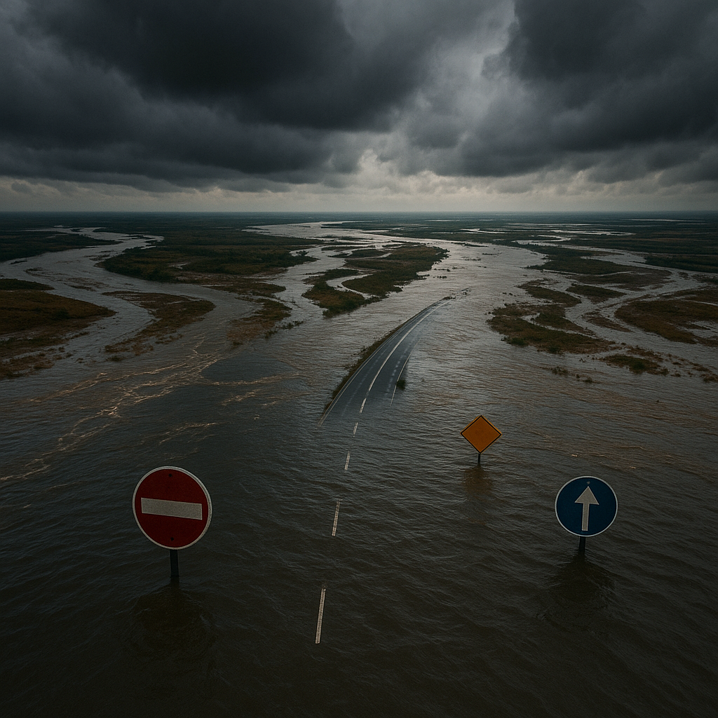
Western Cape deluge 2026: Unprecedented rainfall, R9bn damage, failed defenses, and the human cost of a 1-in-200-year storm.
In May 2026, Cape Town was hit by a massive flood, a "once-in-two-centuries deluge." This disaster happened because three strong low-pressure systems, including a rare hybrid storm, brought a huge amount of rain. The ground was already soaked, and the city's drains couldn't handle the water, leading to widespread flooding and damage. Rivers overflowed, roads were destroyed, and many homes were ruined, causing billions in losses and affecting thousands of lives.
What caused the severe flooding in Cape Town in May 2026?
The severe flooding in Cape Town in May 2026 was caused by a rare sequence of three cut-off low-pressure systems, including a hybrid temperate-tropical low, which delivered a "once-in-two-centuries deluge." These systems brought unprecedented rainfall and winds, exacerbating the impact due to already saturated ground and inadequate drainage infrastructure designed for milder weather.
Get Cape Town news in your inbox
Stay updated with the latest stories from the Mother City.
Sky assault: three lows, one province
Cape winters are rarely polite, yet meteorologists had never seen anything like the triple punch that landed in May 2026. Inside a mere eighteen-day window, three cut-off lows rolled in from the southern Indian Ocean, each nastier than the last. The first, christened “Ingwe” by the South African Weather Service, parked itself northeast of Ceres for thirty-six straight hours and unloaded 312 mm - about a full season’s worth - on the Witzenberg catchment in under two days. Before residents could finish mopping, a second meso-cyclone slid across the Overberg, packing 86 km/h winds that churned already-sodden ground into mud soup. The coup de grâce arrived on 24 May: a rare hybrid temperate-tropical low, “Dikeledi,” slammed ashore near Hermanus, wringing the last drops from a 2 000-kilometre atmospheric river. Statistically, the combined rainfall tallied a once-in-two-centuries deluge for most of the Western Cape.
The sequence stunned even veteran forecasters. Ingwe behaved like a sponge wringer, squeezing moisture from air columns so saturated that radar beams bent downward. Temperature inversions formed overnight, turning Cape Town’s famous tablecloth clouds into a relentless fire-hose aimed at the foothills. By the time Dikeledi crossed the coast, soils from Tulbagh to Swellendam had long since hit field capacity; every additional drop simply raced downhill, gathering silt, stones and debris into a hungry brown stampede.
Seasonal outlooks had hinted at an intense winter, but none of the global models captured the stalling mechanism that kept Ingwe almost stationary for a day and a half. Post-event reanalysis suggests a blocking high over the Kalahari acted like a boulder in a brook, forcing the low to pinwheel in place while its comma-head cloud formation dumped rain on the same real estate for record durations. Climate scientists now use the 2026 event as a textbook example of how a warming sub-tropical ocean can supercharge otherwise ordinary winter storms.
Rivers in revolt: when blueprints met reality
South Africa’s urban drainage code allows councils to design for a one-in-fifty-year storm - if funds are available. Many municipalities never scrape together the cash, so pipes, culverts and retention ponds across the winelands were engineered for milder weather. When Ingwe struck, the Breede River gauge at Swellendam rocketed upward five metres within six hours and peaked at 3 850 cubic metres per second, more than triple the 1981 record. Flood-plain zoning maps along the R60 quietly redrawn in 2019 to accommodate citrus expansion suddenly mattered; 1 800 hectares of three-year-old orchards between Ashton and Bonnievale were submerged under two metres of turbid water, their root systems no match for hydraulic scour.
Engineers describe the region’s storm-water network as “paper defences,” regulations printed on glossy reports but starved of budgets. Worcester’s main canal, designed in 1978 for 180 m³/s, funnelled almost twice that load during the peak. Concrete sidewalls blew out, sending boulders the size of engine blocks spinning into light-industrial yards. Robertson saw a similar story: a R30-million upgrade planned for 2029 happened in June 2026, courtesy of a river that simply re-channels itself when obstructed.
The cost of wishful planning crystallised on satellite images. Blue polygons representing inundated land expanded hour by hour. Citrus farmers who gambled on low-lying orchards discovered that sandy loam turns fluid once pore pressure exceeds confining stress; whole rows of peach and apricot saplings floated away like rafts. Weeks later, stranded fruit still hanging from submerged branches fermented in place, turning river reaches into sour-smelling stew that attracted clouds of fruit flies - a secondary agricultural blight officials had not anticipated.
People in the path: stories behind the statistics
Early tallies show 231 029 residents affected, 22 890 homes damaged or destroyed, 230 road segments closed. Numbers flatten the lived texture of disaster. In Mfuleni, a dense informal settlement east of Cape Town, shacks built below the retention-basin design crest filled like bathtubs after the berm gave way at 02:14 on 21 May. Survivors remember a thunderous rumble, then the metallic clatter of corrugated roofs tumbling downstream; 48 dwellings were swept more than four hundred metres and came to rest against a pedestrian bridge. Miraculously, only two lives were lost, yet the psychological scar persists every time rainclouds gather.
Franschhoek’s 18th-century Huguenot Museum fared no better. Its vaulted cellars - once oak-lined sanctuaries where missionaries matured wine - became underground cisterns. Archivists rescued boxes of mildewed parish records but nineteenth-century fermentation ledgers, leather-bound and hand-written, dissolved into illegible brown pulp. A curator’s wry comment summed up the mood: “We spent decades preserving wine history only to watch it wash away in wine-dark water.”
Across the Cape Flats, similar dramas unfolded on scrubby ground most tourists never see. In Tafelsig, Mitchells Plain, a grandmother tethered her sofa to ceiling beams so it would not float into the bedroom where two toddlers slept. In Touwsranten near the Garden Route, a retired teacher lost a lifetime of unpublished poetry when the Dwars River invaded his study. Disaster reports call these incidents “partial asset loss,” yet each soaked page represents irreplaceable intellectual heritage, the intangible glue of community identity.
Markets, money and the long rebuild
Agriculture took the heaviest punch. Early estimates put direct losses at R5.2 billion: R1.6 billion for pome and stone fruit (blight, fruit-drop, tree mortality), R1.1 billion for wine and table grapes scoured from lower terraces, R0.9 billion for vegetables buried under silt, and R0.6 billion for livestock - 42 000 sheep and 6 700 cattle drowned or later euthanised. Add another R1 billion for wrecked pack-houses, cold stores and irrigation lines. The Langkloof, supplier of roughly one in five South African apples, lost 14% of bearing acreage; export statistics will feel that shortfall until 2028.
Transport infrastructure fared no better. Repair bills already approach R2 billion and could double once geotechnical crews finish probing slide planes. The N2 at Sir Lowry’s Pass remains severed after a forty-metre slice of uphill carriageway dropped twelve metres overnight. Engineers are drilling thirty-metre rock anchors, yet every fresh downpour suspends concrete pours. Cargo bound for the Port of Cape Town now snakes inland, adding R0.08 per kilogram to citrus freight. Truckers joke grimly that lemons are earning airline miles without boarding any aircraft.
Budget officials face an unforgiving ledger. Provincial Treasury’s 2026/27 books already earmark 74% of discretionary capital for roads, health and schooling. Reallocations tabled so far - freezing vehicle purchases, capping middle-management pay, halving tourism marketing, postponing nine new schools - cover only 22% of the likely R9-billion price tag. National Treasury’s disaster kitty is almost empty after tornadoes in KwaZulu-Natal and fires in Limpopo earlier in the year. Somewhere between balance sheets and broken culverts, the province must invent a path to solvency without sacrificing classrooms or clinics.
{"faq": [{"question": "What caused the severe flooding in Cape Town in May 2026?", "answer": "The severe flooding in Cape Town in May 2026 was caused by a rare sequence of three cut-off low-pressure systems, including a hybrid temperate-tropical low named 'Dikeledi'. These systems, including 'Ingwe' and another meso-cyclone, delivered a \"once-in-two-centuries deluge\" of rainfall. The impact was exacerbated by already saturated ground, inadequate drainage infrastructure designed for milder weather, and a blocking high-pressure system over the Kalahari that kept 'Ingwe' almost stationary."}, {"question": "What was the extent of the rainfall during this disaster?", "answer": "The rainfall was unprecedented, with 'Ingwe' alone unloading 312 mm – a full season's worth – on the Witzenberg catchment in under two days. The combined rainfall from the three systems was statistically considered a once-in-two-centuries deluge for most of the Western Cape. This extreme precipitation overwhelmed the region's natural and engineered systems."}, {"question": "Why couldn't Cape Town's infrastructure handle the floodwaters?", "answer": "Cape Town's infrastructure, particularly its urban drainage code, is designed for a one-in-fifty-year storm, and many municipalities lack the funding to even meet these standards. When the 'once-in-two-centuries deluge' hit, pipes, culverts, and retention ponds, engineered for milder weather, were quickly overwhelmed. For example, Worcester's main canal, designed for 180 m³/s, handled almost double that load, leading to structural failures."}, {"question": "What were the human and cultural impacts of the flooding?", "answer": "The floods affected 231,029 residents, damaged or destroyed 22,890 homes, and closed 230 road segments. In informal settlements like Mfuleni, shacks were swept away, though miraculously with minimal loss of life. Culturally, the 18th-century Huguenot Museum in Franschhoek saw historical documents and fermentation ledgers destroyed. Many individuals lost irreplaceable personal items, from unpublished poetry to family heirlooms, underscoring the profound personal toll beyond statistics."}, {"question": "How did the agricultural sector suffer from the floods?", "answer": "Agriculture took the heaviest hit, with direct losses estimated at R5.2 billion. This included R1.6 billion for pome and stone fruit, R1.1 billion for wine and table grapes, R0.9 billion for vegetables, and R0.6 billion for livestock (42,000 sheep and 6,700 cattle drowned or euthanized). Additionally, R1 billion was lost in damaged pack-houses, cold stores, and irrigation lines. The Langkloof, a major apple supplier, lost 14% of its bearing acreage, with export impacts expected until 2028."}, {"question": "What are the financial implications for the province's recovery?", "answer": "The repair bills for transport infrastructure alone are approaching R2 billion and are expected to double. The N2 at Sir Lowry's Pass remains severed, causing significant rerouting of cargo and increased costs. Provincial Treasury's 2026/27 budget, with 74% allocated to roads, health, and schooling, faces a likely R9-billion price tag for the disaster. Reallocations, such as freezing vehicle purchases and postponing new schools, only cover 22% of this cost, and National Treasury's disaster funds are depleted, presenting a significant financial challenge for recovery."}], "title": "Frequently Asked Questions: Cape Town Floods May 2026"}

Sizwe Dlamini is a Cape Town-based journalist who chronicles the city’s evolving food scene, from boeka picnics in the Bo-Kaap to seafood braais in Khayelitsha. Raised on the slopes of Table Mountain, he still starts every morning with a walk to the kramat in Constantia before heading out to discover whose grandmother is dishing up the best smoorsnoek that day.
View all articles →