
City schedules ecological burns to restore biodiversity and reduce wildfire risk
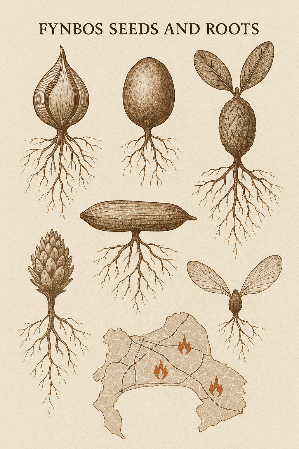
Explore Cape Town's controlled burns: a 3-day dance with fire, igniting fynbos, ensuring safety, and revealing nature's resilience.
Cape Town deliberately sets fires, called prescribed burns, to keep its unique fynbos plants healthy. These controlled fires help seeds sprout and stop bigger, more dangerous wildfires by clearing old brush. It's like a carefully planned show where fire helps nature grow back even stronger and more colorful.
Why does Cape Town intentionally set fires?
Cape Town intentionally sets fires, known as prescribed burns, to manage its unique fynbos ecosystem. These controlled burns are crucial for seed germination of many native plants, which require heat and smoke to sprout. They also prevent hotter, more destructive wildfires by reducing fuel loads and promoting ecological regeneration.
Get Cape Town news in your inbox
Stay updated with the latest stories from the Mother City.
A street-level tour of the flames, the flora, and the invisible choreography that lets a city burn on purpose while its seeds throw a post-fire party
1. The Calendar No-one Hangs on a Wall
-
02 March, dawn*
The Blaauwberg duneland - 33.807° S, 18.508° E - lies pinned between the R27’s morning choir of hatchbacks and the cold cobalt of Table Bay. A 10-hectare rectangle of Cape Flats sand fynbos will be the first matchbox. The ignition slot is 09:30-13:00, wind must stay under 15 km/h from the south-east, and humidity has to loiter between 45 and 65 %. If clouds exceed 30 % coverage or the mixing height sinks below 600 m, everyone goes home and tries again seven days later. -
03 March, mid-morning*
Tucked between Steenberg Road, Oukaapseweg and the relentless delivery-van rumble to the mall, Westlake Conservation Centre offers up 2.11 ha of Peninsula granite fynbos - 12 % of the planet’s total within a 25 km radius - plus a pinch of sand fynbos so scarce its head-count is lower than that of African wild dogs. The match can strike between 08:00 and 11:30; back-up is 10 March. -
04 March, first light*
Tygerberg’s western flank - 33°52′10″ S, 18°36′23″ E - donates 33 ha of Swartland Shale Renosterveld, a vegetation type that has already surrendered 79 % of its original real estate to wheat and brick kilns. The slope tilts 12–18 °, faces north-west (the side that dries fastest and burns hottest), and the window runs 07:00-13:00. Fail here and the_retry is 11 March.
2. The Script Written by Water, Wind and Seed
Cape Town occupies the tiniest yet most extravagant of the globe’s six floral kingdoms. Every leaflet, cone and seed coat here carries the same memo: wait for heat.
Cape Flats sand fynbos keeps its future generation 3–5 cm underground in ant granaries. Pass 50 °C through the sand and the wax on the seed coat fractures; smoke-borne chemicals flip the genetic on-switch. Skip the flame and 40 % of species will boycott germination, no matter how generously winter rains beg.
Peninsula granite fynbos locks seeds in woody, fire-proof cones on the parent shrub. The cones yawn within hours of the flame’s farewell, dumping seed onto a fresh ash buffet. Satellite pixels record green-up exceeding 60 % cover in nine months - one of Earth’s fastest vegetative comebacks.
Swartland Shale Renosterveld is a bulb republic. Each square metre conceals 40–80 geophytes that paint the slope in Monet strokes the first spring after flame. Torch the hill too often and the bulbs starve; burn too seldom and the asteraceous canopy bullies them into permanent shade. Cape Town’s seven-to-twenty-year fire cadence is cribbed from 1800s surveyors’ journals that raved about post-fire flower extravaganzas after accidental ignitions.
3. The Human Machinery Behind a “Natural” Blaze
The permit wad is 11 mm thick and weighs 87 g. It holds an Atmospheric Emission Licence valid for 48 h and chained to live PM10 readings from Table View; a biodiversity exemption that survived a 30-day public-comment round (three e-mails: two fretting over tortoises, one proffering braai tips); and a four-page Fire Service map listing hydrant flow rates, helicopter dip sites, and four horse-owning residents’ cellphone digits.
The burn clan totals fourteen: two ecosystem-fire officers clutching “Ignition Specialist” tickets, four field rangers armed with NQF-5 conservation diplomas, and eight seasonal wildland firefighters recruited from Khayelitsha and Mitchells Plain after 40 hours of pack-hike torture and 20 hours of classroom fire-behaviour algebra.
Hardware includes two 4×4 fire tenders (750 l per minute, 1 800 l belly), a 1-ton “bakkie skit” that flings foam 40 m like an angry windmill, and a fixed-wing spotter parked at Morningstar at R2 800 per hour until the smoke pillar tops 300 m. Lighters range from aluminium drip-torches sloshing a blood-red 4:1 diesel-premix to a drone that spits potassium-permanganate ping-pong balls primed with antifreeze onto shale cliffs where boots fear to tap dance.
4. Ten Hectares in Ten Paragraphs – Blaauwberg Unfolds
-
08:15*
A weather balloon launched from Cape Town International radios back: 12 km/h surface wind, gusts 17, 19 °C, 58 % humidity. WhatsApp group “BB-Burn-Ops” flashes green: Condition A, play on. -
08:45*
Traffic officers dial the R27 down to 60 km/h contraflow; weekend surfers mutter at amber lights slicing their dawn-patrol convoy. -
09:30*
A 5 m test strip ignites downhill; flames lick 20 cm and crawl 0.08 m/s - textbook manners. -
09:55*
Crews stride the up-slope line, painting fire every second metre with drip-torches. Maximum flame height 1.4 m - low enough to leave the coastal black harrier’s nest platform 60 m away un-singed. -
10:20*
The smoke column bends seaward, photobombing a finance firm’s 19th-floor PowerPoint. Instagram panics: “Table Mountain’s ablaze!” #CapeTown trends in Berlin before lunch. -
11:00*
Infrared eyes in the sky report 8 ha charcoal and 2 ha unburnt islands - beetle Airbnb left intact. -
11:30*
Mop-up militia rake every cow-pat and thatch tuft; buried probes read 43 °C - cool enough to sleep. -
12:45*
The City’s Twitter feed drops a four-photo thread; insurance companies retweet faster than surfers can claim lost boards. -
13:10*
The ignition officer signs the burn-complete chit. Total diesel toll: 42 l, equal to a Cape Town–Caledon weekend in a Ford Ranger.
5. Street-Level Smoke Signals – What the Plume Tells the Neighbours
Over Big Bay the plume drifts north-west, powdering kitesurf lines with ash that smells oddly of eucalyptus - actually Leucadendron laureolum cones off-gassing phenolics.
In Westlake, pine resin aroma triggers panic, but the pines were chainsawed years ago; the scent comes from private slash piles flirted with stray embers.
At Tygerberg Hospital, oncology nurses slam windows when PM10 hits 85 µg/m³. Inside, patients gaze at the blackened hill and joke the view finally matches their scans.
6. Tiny Creatures, Big Escape Plan
Volunteers spend the day before the burn on “torso patrol,” ferrying 11 geometric tortoises - rarer than black rhinos - to a temporary nursery at Tygerberg; two days later the shells saunter back to feast on neon geophyte shoots.
Cape sand frogs feel the heat, skid downhill, and are herded by mist-netted corridors into damp refugia that never saw flame.
Table Mountain copper butterflies keep their ant landlords safe inside 5 m micro-islands where fire intensity is throttled below 500 kW/m - gentle enough to spare the thatch above the ant metropolis.
7. Hidden Ledgers of Flame
Blaauwberg bees pump an extra 28 kg of honey per hive the spring after fire; farm-gate price leaps from R85 to R120 per kg.
Pink Watsonia spikes draw illegal bouquet pickers who can clear R400 a day on the N7 off-ramp; rangers now camp out every September.
Although pocket-sized, the burns prevent hotter wildfires - 33 ha of avoided flame could spare 180 t CO₂-e over a decade, a figure now woven into the City’s climate playbook even if carbon traders yawn.
8. Tech that Doesn’t Make the Headlines
NASA’s VIIRS satellite e-mails a 375 m resolution fire shapefile to City GIS nerds within three hours - handy ammunition for morning-after press briefings.
The home-grown “CapeFire” app crowdsources smoke pics; an algorithm labels them prescribed, wild or hoax with 87 % accuracy, slashing control-room prank calls.
QR-tagged aluminium pegs hammered every 50 m will be scanned in 2026 to track vegetation rebound to the millimetre - tech borrowed from Australian mine-site rehab.
9. After the Ash Cools – a Timeline of Rebirth
- Week 1:* Soil temps drop below 35 °C, mycorrhizae wake, ants start redecorating.
- Week 3:* 15 mm of rain dissolves ash into a potassium cocktail; seedling fireworks peak at day 18.
- Month 3:* Annuals carpet the slope; drivers on the N1 swear the hillside has turned emerald overnight.
- Year 3:* New protea crowns reach your knees and 45 bulb species cram into every 100 m² quadrat.
- Year 12–15:* Fuel load quietly returns to pre-burn levels; algorithm-armed drone swarms may pick the next ignition date while humans sleep.
10. How to Read the Smoke Like a Local
White with a blue edge? That’s grass and fine fuel fresh out of the matchbox.
Orange-brown swirl? Shrubs and bark are mid-shift.
Black anvil flattening aloft? Eucalyptus or pine - phone it in, fast.
If the plume leans left (anti-clockwise) the wind is shearing upward - great for prescribed burns, grim for ridge-top hikers.
A fast horizontal smoke train equals a head-fire marching; a mushrooming tower means the slope just steeper than 20 ° or heavy fuel is having its day.
11. Pocket Glossary for Smoky Braai Talk
Back-burn: Fire told to march into the wind so the main blaze starves.
Blackline: Scorched perimeter that behaves like a fireproof fence.
Drip-torch: Metal watering can from hell that dribbles liquid flame.
Flame-length × 1.5 = hose length you’ll need before things get intimate.
Red-flag day: When 30 °C heat, sub-20 % humidity and 30 km/h wind align - prescribed burns cancel, backyard braais become outlawed.
12. Numbers You Can Save, Rumours You Can Ignore
WhatsApp burn-status bot: 072 601 3002
Live air-quality graphs: cityofcapetown.gov.za/air
Downloadable burn-boundary maps: capefarmmapper.capetown.gov.za
Real wildfire? Dial 107 (landline) or 021 480 7700 (cell), or voice-note 063 693 6348 for GPS-tagged reports.
For the rest of the week, the city will smell like crushed pine and toasted protea, sirens will sing by design, and the black slopes will already be writing their next green chapter in a dialect older than tar and brick.
Why does Cape Town intentionally set fires?
Cape Town intentionally sets fires, known as prescribed burns, to manage its unique fynbos ecosystem. These controlled burns are crucial for seed germination of many native plants, which require heat and smoke to sprout. They also prevent hotter, more destructive wildfires by reducing fuel loads and promoting ecological regeneration.
How does Cape Town decide when and where to conduct these prescribed burns?
Prescribed burns are meticulously planned with strict environmental conditions. For instance, a burn in the Blaauwberg duneland requires wind under 15 km/h from the south-east and humidity between 45% and 65%. Specific ignition windows are set, and if conditions aren't met, the burn is postponed, sometimes for a week. The planning also involves extensive permitting, considering factors like air quality, biodiversity impact, and proximity to residential areas.
What types of fynbos ecosystems benefit from these fires, and how?
Different fynbos types have unique responses to fire. Cape Flats sand fynbos seeds are stored underground by ants and require heat and smoke chemicals to germinate. Peninsula granite fynbos holds seeds in fire-proof cones that open after a fire, releasing them onto nutrient-rich ash. Swartland Shale Renosterveld, a 'bulb republic,' relies on a specific fire cadence (7-20 years) to prevent bulbs from being starved by too frequent burns or overshadowed by dense canopy if burns are too infrequent.
What human and technological resources are involved in a prescribed burn?
A team of fourteen, including Ignition Specialists, field rangers, and wildland firefighters, orchestrates these burns. They use specialized equipment such as 4x4 fire tenders, foam-flinging bakkie skits, and fixed-wing spotters. Lighters vary from traditional drip-torches to drones that deploy potassium-permanganate ping-pong balls. Permits are extensive, covering environmental licenses, public comments, and detailed fire service maps.
How do animals and plants cope with these intentional fires?
Specific measures are taken to protect wildlife. For example, geometric tortoises are temporarily relocated to nurseries before a burn and returned afterward. Cape sand frogs are herded into damp refugia, and safe micro-islands are maintained for creatures like the Table Mountain copper butterflies and their ant colonies. The fires are also choreographed to ensure maximum flame height does not harm nearby bird nests.
What are the long-term ecological and economic benefits of prescribed burns?
Beyond preventing large wildfires, these burns stimulate rapid ecological recovery, with green-up observed within months and new plant growth reaching significant heights within a few years. They also have economic benefits, such as increased honey production (e.g., Blaauwberg bees produce an extra 28 kg per hive post-fire) and the prevention of significant carbon emissions by avoiding larger, uncontrolled blazes. The City even uses technology like QR-tagged pegs to track vegetation rebound to the millimeter.

Amanda Wilson is a Cape Town-born journalist who covers the city’s evolving food scene for national and international outlets, tracing stories from Bo-Kaap spice shops to Khayelitsha micro-breweries. Raised on her grandmother’s Karoo lamb potjie and weekend hikes up Lion’s Head, she brings equal parts palate and pride to every assignment. Colleagues know her for the quiet warmth that turns interviews into friendships and fact-checks into shared laughter.
View all articles →